
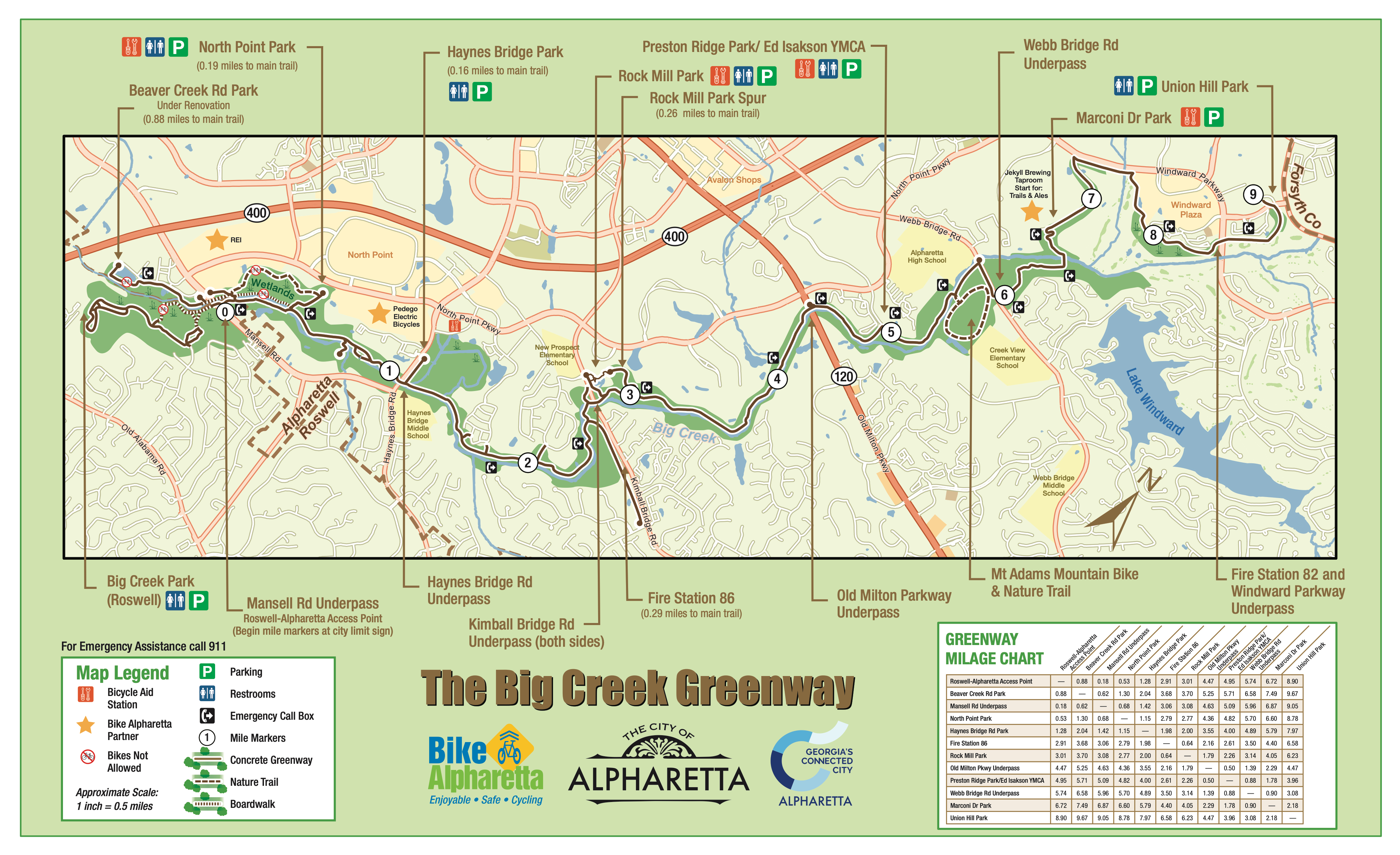
Big Creek Greenway, Alpha Loop and City Bike Routes
The Big Creek Greenway was extended in June 2021, to provide 9 miles in Alpharetta, plus 1.5 miles in Roswell! You can now walk, ride, roll or ride between Marconi Drive and Union Hill Park on the new extension, and it’s all concrete and provides a tunnel under Windward Parkway! There is a connection using Ronald Reagan Parkway’s multi-purpose path to access Halcyon and the Forsyth Greenway, but please use caution with construction on McGinnis Ferry Road.
The Alpha Loop is under development as by the Alpha Loop Foundation as a network of urban, multi-use trails that links four of Alpharetta’s key activity centers – Avalon, Downtown, the North Point Eco District, and Northwinds. Plans are currently underway to expand the path network through woods paralleling Georgia 400 to connect Kimball Bridge Road at the north and to Encore Parkway to the south. Along the way, the Alpha Loop will pass through The Gathering on Haynes Bridge Road before arriving at the North Point Eco District.
The City of Alpharetta adopted four City Bike Routes and a City Bike Routes Map in 2015 for connectivity to parks, schools and shopping. These routes are marked on Share the Road sign posts with a designated route color and the number of miles to/from the new City Center, ranging from six to 16 miles. The Orange Route (12 miles) and Yellow Route (9 miles) provide connections to the Big Creek Greenway. SPECIAL NOTE – As of 2025 there has been extensive construction on Webb Bridge Road (Orange and Yellow routes) as well as McGinnis Ferry Road (Purple route); use extreme caution. If you want to try one of the City Bike Routes, the best place to start is at the Alpharetta Library and look for the color coded arrows on a signpost where Park Plaza connects at Haynes Bridge Road. The purple, red and yellow routes go East of City Center and the blue route goes West of City Center, signed for one direction. Blue is the shortest route and has the fewest hills!
Useful links for Bike Maps
- Big Creek Greenway Map (see below)
- Alpha Loop Map (in development)
- City Bike Routes Map (use caution with road construction)
- Big Creek Greenway – park rules


Local Bike Shops and Organizations
Atlanta Cycling – two locations
1570 Holcomb Bridge Rd, Roswell
869 N Main St, Alpharetta
atlantacycling.com
Cannon Cyclery
1000 Northfield Ct #150, Roswell
cannoncyclery.bike
Fresh Bike Service
1575 Old Alabama Rd #209, Roswell
freshbikeservice.com
ATL E-bikes
6480 North Point Pkwy #1100B
peddleroffun.com
Reality Bikes
20 Tri-County Plaza, Cumming
realitybikes.com
REI Co-op Alpharetta
7531 North Point Pkwy, Alpharetta
rei.com/stores/alpharetta
Roswell Bicycles
670 Houze Way, Roswell
roswellbicycles.com
Whitetail Bicycles & Cyclery Cafe
1885 Heritage Walk, Milton
facebook.com/whitetailbicycles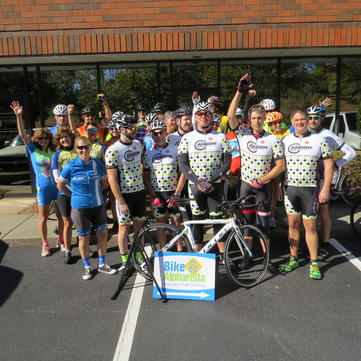
PARTNER ORGANIZATIONS:
RAMBO (Roswell Alpharetta Mountain Bike
Organization:
rambo-mtb.org/about-1
NITRO (North-Metro Interscholastic Trail Riding
Organization)
nitromtb.com
Bike Roswell
bikeroswell.com
Click It and Fix It

The City of Alpharetta is partnering with 3rd party provider, SeeClickFix.com, in a program to provide citizens & businesses with a method of reporting issues within the city.
SeeClickFix.com is an online web application that allows any individual to report non-emergency issues such as graffiti, potholes or traffic safety issues on a map for everyone to see. Click Here
MARTA and Bicycle Commuting
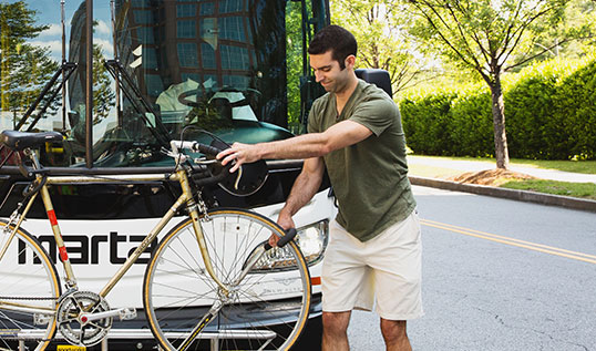
Driving isn’t your only option for getting around Alpharetta, or for commuting to other metro communities. Try using your bicycle for your commute, even if just once a week. You can use the Big Creek Greenway to easily move along the north-south corridor near N. Point Parkway and to access Park & Ride lots on Mansell Road and N. Point Parkway. MARTA is a bike-friendly option for east-west connections, as every bus has storage racks for two bikes. Once on a MARTA train, all offer plenty of room for both you and your bicycle.
Read more here.
The Alpha Loop is progressing even more!
The City of Alpharetta continues to build out the Alpha Loop, a multi-use pathway that connects key city locations. Recently, the City Council approved connections to the Greenway. Keep up to date on developments and maps at the city website:
Position Statement – Webb Bridge Road
Bike Alpharetta appreciates the continued opportunity to provide input to the City of Alpharetta on the design of the Webb Bridge Corridor. At the meeting on October 10th and 11th, the City presented new design options. Bike Alpharetta is aligned with the City and is pleased to see incorporation of cycling specific infrastructure to allow for accessible and safe cycling.
After further consideration of the options presented, we believe that on-road bike lanes are the best option, rather than the raised, separated bike lane directly next to a path. This will allow cyclists to transition more easily with traffic in order to make turns and, in general, provide for safer crossing at intersections.
We would also like to make an additional suggestion. Where there is sufficient room, we would like the city to consider a painted, striped buffer separating the vehicle lane from the four-foot bike lane. We believe that this would provide some additional security to cyclists and increase usage as well.
Online map provided by City – click here
